A NEW version of the software app Skippy Scout has been launched and is ten times faster than its predecessor. Agriculture software specialist Drone Ag has just introduced the Skippy Scout version 2.5, which it says is a big step forward and will save a lot of time with field management.
The original Skippy app could fly a drone to scout points in a field five times faster than traditional crop walking. However, the new 2.5 version has more functionality and is ten times faster, enabling users to cover up to 25 acres in just five minutes.
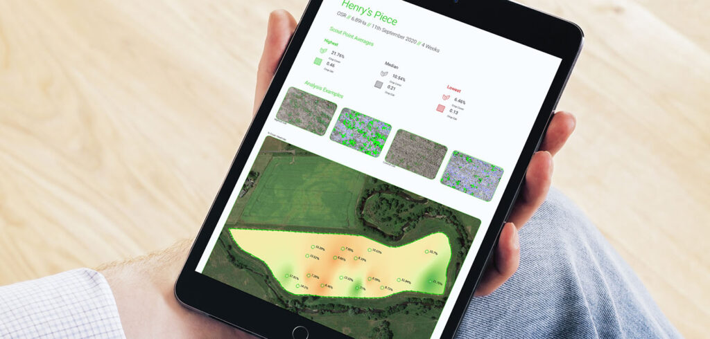
Skippy Scout 2.5 offers field overview, automated scouting and PDF field reports using maps uploaded by the user, and images taken by the drone.

Drone Ag founder Jack Wrangham, said: “Our image analysis takes only minutes to provide an easy-to-understand report of the whole field.
“These reports are generated using unique artificial intelligence (AI) interpretation to flag up potential crop issues and can also be compared to satellite and yield maps to find correlations in field performance.
“It also provides a breakdown with indicators for green area index (GAI), healthy and unhealthy crop cover percentage, weed percentage, and it gives an insect damage measurement,” he said.
Users can therefore identify crop issues such as weeds or pests more quickly by subsequently viewing the leaf level images on their phone or tablet.
Jack added: “Long term, the reports will also benchmark fields of the same crop to provide a picture of changes and crop progress over time.
“It is easy to start using Skippy. Anyone who owns a drone can sign up online with monthly subscriptions starting from just £30. In February and March, we will be streaming live demonstrations so anyone who wants to see Skippy in action can tune in and see how it works,” he said.
Existing users can update their app to version 2.5 for free now, and new users will benefit from all of the additional features when they register.
How Skippy Scout works
As a starting point a field map image from any source is uploaded to the app. The number and location of monitoring points within the field (on that map) are then selected by the controller who simply taps on-screen to mark them.
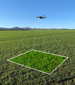
Once the drone is flying it arrives at each target point, descends to 2m above the crop using on-board sensors, and then photographs the crop in detail.
As the flight completes, the photographs upload automatically to the operator’s phone or tablet, allowing them to be reviewed immediately.
The level of detail is sufficient to identify leaf damage or disease, as well as identify weeds as small as the cotyledon stage.
[Image source: Drone Ag]


